Lab Seminar: Predicting Maize Yields at Large Scale using Remote Sensing
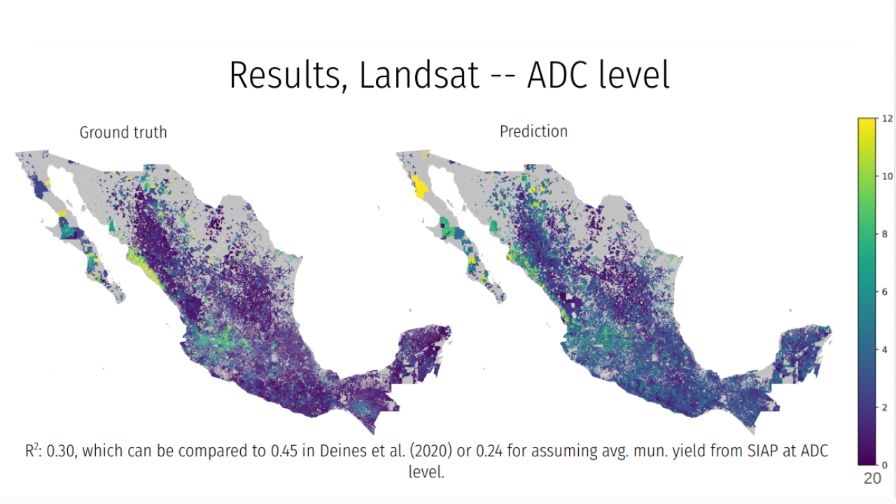
New ARE faculty member Dr. Jay Sayre presented his work on the use of remote sensing methods to predict agricultural and ecological outcomes at fine scale using only relatively aggregated, publicly available data. He showed how he and his co-authors combine machine learning algorithms that capture agronomic features of crop growth trained on satellite imagery to estimate maize yields in Mexico. Their model predicts yield at accuracies largely in line with the literature, despite only using aggregated data, rather than more expensive sources of precise ground truth information. Jay also illustrated how this method can be used to improve publicly available survey data that may be subject to misreporting.